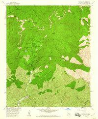
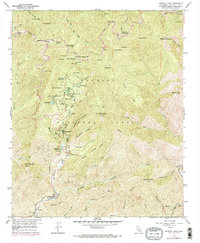
1958 Map of Crystal Lake
USGS Topo · Published 1960About this map
Crystal Lake Recreation Area serves as the focal point for this high-altitude landscape in the Angeles National Forest. Mapped during the late 1950s, the terrain is defined by the steep ridges and peaks of the San Gabriel Mountains, including Mt Baden-Powell and Mt Islip. The map documents a developed recreational infrastructure from the mid-century era, featuring the Crystal Lake Guard Sta. and an Outdoor Theater near the lake. The Angelles Crest Highway winds across the northern ridges, passing through Islip Saddle and Dawson Saddle, providing access to numerous springs and designated camps like Little Jimmy Campground. The hydrology is equally detailed, tracing the headwaters of the North Fork San Gabriel River and the South Fork Big Rock Creek, alongside smaller landmarks like Falling Springs and Mine Gulch, which suggest the area's geological and prospecting history.
Find a feature on this map
66 named features on this map. Tap any name to fly to it.
Don’t see what you’re looking for? This feature index may not catch every label — zoom into the map to look around manually.
Map Details
Editions of this 1958 Crystal Lake Map
5 editions found
Other maps of this area

1894 · Pomona
USGS Topo · 1:62,500

1897 · Pomona
USGS Topo · 1:62,500

1897 · Cucamonga
USGS Topo · 1:62,500

1898 · Pomona
USGS Topo · 1:62,500

1900 · Cucamonga
USGS Topo · 1:62,500

1901 · Southern California Sheet No. 1
USGS Topo · 1:250,000

1903 · Rock Creek
USGS Topo · 1:62,500

1903 · Cucamonga
USGS Topo · 1:62,500

1903 · San Antonio
USGS Topo · 1:62,500

1904 · Pomona
USGS Topo · 1:62,500