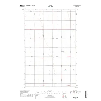
2020 Map of Crystal NE
USGS Topo · Published 2020About this map
Willow Creek meanders through this agricultural landscape in northeastern North Dakota, marking one of the few natural breaks in the precise grid of section lines and gravel roads. In this corner of Pembina County, the landscape is defined by its rectilinear organization, with north-south routes like 143rd Ave NE and east-west corridors such as 88th St NE providing access to the fertile fields. The area's social and community history is anchored by its rural burial grounds, including the Lodema Cem and the Saint Pauls Lutheran Church Cem. These sites, along with the surrounding townships such as t160n r54w, represent the long-standing settlement patterns of the Red River Valley. The terrain is remarkably level, characteristic of the ancient glacial lake bed that supports the region's intensive farming heritage.
Find a feature on this map
25 named features on this map. Tap any name to fly to it.
Don’t see what you’re looking for? This feature index may not catch every label — zoom into the map to look around manually.
Map Details
Editions of this 2020 Crystal NE Map
This is the sole edition of this map. No revisions or reprints were ever made.
Other maps of this area

1939 · Glasston
USGS Topo · 1:62,500

1939 · Cavalier
USGS Topo · 1:62,500

1941 · Glasston
USGS Topo · 1:62,500

1941 · Cavalier
USGS Topo · 1:62,500

1941 · Bathgate
USGS Topo · 1:62,500

1944 · Crystal
USGS Topo · 1:62,500

1952 · Thief River Falls
USGS Topo · 1:250,000

1956 · Thief River Falls
USGS Topo · 1:250,000

1957 · Thief River Falls
USGS Topo · 1:250,000

1963 · Crystal SE
USGS Topo · 1:24,000