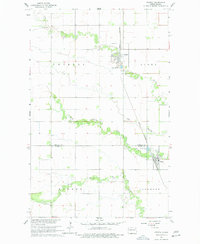
1963 Map of Crystal
USGS Topo · Published 1978About this map
Crystal stands as a primary rail hub on this mid-century survey, situated at the intersection of local township boundaries and the Great Northern railroad line. The landscape is defined by the winding paths of the North Branch Park River and the Middle Branch Park River, which drain the surrounding agricultural lands across Crystal, Elora, Dundee, and Glenwood townships.
Find a feature on this map
16 named features on this map. Tap any name to fly to it.
Don’t see what you’re looking for? This feature index may not catch every label — zoom into the map to look around manually.
Map Details
Editions of this 1963 Crystal Map
2 editions found
Other maps of this area

1944 · Crystal
USGS Topo · 1:62,500

1952 · Thief River Falls
USGS Topo · 1:250,000

1956 · Thief River Falls
USGS Topo · 1:250,000

1957 · Thief River Falls
USGS Topo · 1:250,000

1963 · Crystal SE
USGS Topo · 1:24,000

1963 · Crystal
USGS Topo · 1:24,000

1963 · Edinburg
USGS Topo · 1:24,000

1963 · Gardar
USGS Topo · 1:24,000

1963 · Nash
USGS Topo · 1:24,000

1963 · Park River
USGS Topo · 1:24,000