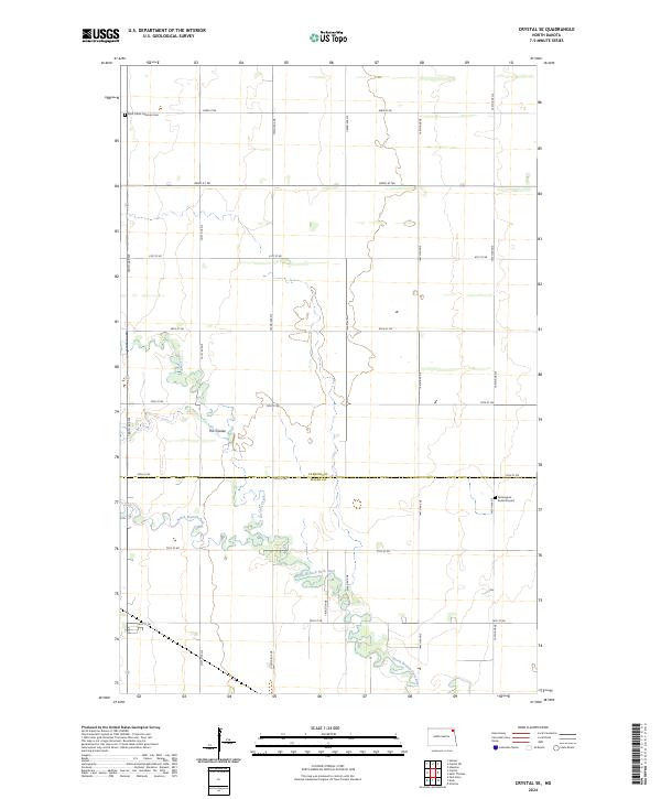
2024 Map of Crystal SE
USGS Topo · Published 2024About this map
North Branch Park River meanders across the southern portion of this landscape, its path and associated wetlands contrasting with the rigid, square-mile grid of the Public Land Survey System. This rural area, straddling the boundary between Pembina Co and Walsh Co, is defined by its agricultural layout, where arterial roads like 144th Ave NE and 78th St NE partition the prairie. For genealogists, the map identifies local landmarks such as Saint Johns Lutheran Cem in the northwest and the Farmington Burial Ground to the east. Water features like Cart Creek and the marshy depression known as The Coulee break up the flat topography, indicating the natural drainage patterns that have shaped land use and field boundaries in this corner of North Dakota.
Find a feature on this map
24 named features on this map. Tap any name to fly to it.
Don’t see what you’re looking for? This feature index may not catch every label — zoom into the map to look around manually.
Map Details
Editions of this 2024 Crystal SE Map
This is the sole edition of this map. No revisions or reprints were ever made.
Other maps of this area

1939 · Glasston
USGS Topo · 1:62,500

1941 · Glasston
USGS Topo · 1:62,500

1943 · Grafton
USGS Topo · 1:62,500

1944 · Crystal
USGS Topo · 1:62,500

1952 · Thief River Falls
USGS Topo · 1:250,000

1956 · Thief River Falls
USGS Topo · 1:250,000

1957 · Thief River Falls
USGS Topo · 1:250,000

1960 · Grafton
USGS Topo · 1:24,000

1963 · Crystal SE
USGS Topo · 1:24,000

1963 · Crystal
USGS Topo · 1:24,000