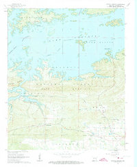
1962 Map of Crystal Springs
USGS Topo · Published 1963About this map
Lake Ouachita dominates the northern half of this landscape, its shoreline defined by controlled inundation patterns that shaped the region during the early 1960s. South of the water, the Ouachita National Forest covers the ridges of Bear Mountain and Hickorynut Mountain, where the topography drops sharply toward Little Bear Creek. The map records the intersection of outdoor recreation and older rural foundations, as seen at Crystal Springs Landing and the Buckville Recreational Area. Genealogical interest is found in the scattered community markers of the Valley, including Valley Sch, the Church of God, and Lowe Cem. Traces of earlier settlements like Buckville and Cedar Glades appear as names on the land near the rising waters of the Ouachita River.
Find a feature on this map
27 named features on this map. Tap any name to fly to it.
Don’t see what you’re looking for? This feature index may not catch every label — zoom into the map to look around manually.
Map Details
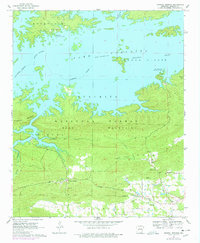
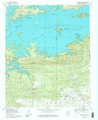
Editions of this 1962 Crystal Springs Map
4 editions found
Other maps of this area

1890 · Hot Springs
USGS Topo · 1:125,000

1894 · Hot Springs
USGS Topo · 1:125,000

1955 · Little Rock
USGS Topo · 1:250,000

1956 · Little Rock
USGS Topo · 1:250,000

1960 · Little Rock
USGS Topo · 1:250,000

1962 · Crystal Springs
USGS Topo · 1:24,000

1962 · Avant
USGS Topo · 1:24,000

1962 · Fannie
USGS Topo · 1:24,000

1962 · Mc Graw Mountain
USGS Topo · 1:24,000

1964 · Little Rock
USGS Topo · 1:250,000