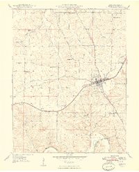
1948 Map of Cuba
USGS Topo · Published 1948About this map
Cuba serves as the focal point of this 1948 survey, where the St Louis San Francisco railroad cuts a diagonal path through the landscape. This corridor was the lifeblood of the Crawford County economy, linking the town's grid with smaller settlements like Fanning and Idlewild. The terrain is defined by a dense network of country schoolhouses and family-named cemeteries, indicating a deeply settled rural community where education and local history were centered around landmarks like Pleasant Ridge Sch and Iron Ridge Sch.
Find a feature on this map
33 named features on this map. Tap any name to fly to it.
Don’t see what you’re looking for? This feature index may not catch every label — zoom into the map to look around manually.
Map Details
Editions of this 1948 Cuba Map
5 editions found
Other maps of this area

1903 · Sullivan
USGS Topo · 1:125,000

1928 · Meramec Spring
USGS Topo · 1:62,500

1932 · Steelville
USGS Topo · 1:48,000

1933 · Steelville
USGS Topo · 1:62,500

1934 · Redbird
USGS Topo · 1:62,500

1937 · Steelville
USGS Topo · 1:62,500

1938 · Redbird
USGS Topo · 1:62,500

1948 · Cuba
USGS Topo · 1:24,000

1948 · Leasburg
USGS Topo · 1:24,000

1948 · Argo
USGS Topo · 1:24,000