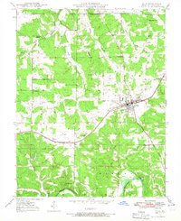
1948 Map of Cuba
USGS Topo · Published 1967About this map
Cuba serves as the primary hub of this 1948 topographic study, where the St Louis San Francisco railroad and several primary roads converge. The surrounding landscape in Crawford County is defined by a dense network of rural schoolhouses and family cemeteries, reflecting a settled agrarian community at mid-century. To the west, the settlement of Fanning sits along the rail line, while the southern reaches of the map are dominated by the winding path of the Meramec River near Idlewild.
Find a feature on this map
34 named features on this map. Tap any name to fly to it.
Don’t see what you’re looking for? This feature index may not catch every label — zoom into the map to look around manually.
Map Details
Editions of this 1948 Cuba Map
5 editions found
Other maps of this area

1903 · Sullivan
USGS Topo · 1:125,000

1928 · Meramec Spring
USGS Topo · 1:62,500

1932 · Steelville
USGS Topo · 1:48,000

1933 · Steelville
USGS Topo · 1:62,500

1934 · Redbird
USGS Topo · 1:62,500

1937 · Steelville
USGS Topo · 1:62,500

1938 · Redbird
USGS Topo · 1:62,500

1948 · Cuba
USGS Topo · 1:24,000

1948 · Leasburg
USGS Topo · 1:24,000

1948 · Argo
USGS Topo · 1:24,000