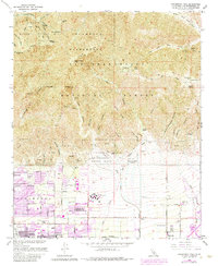
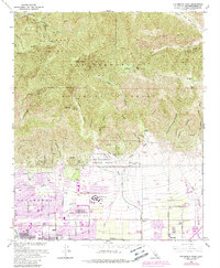
1966 Map of Cucamonga Peak
USGS Topo · Published 1984About this map
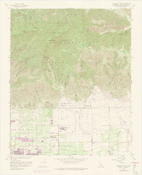
Cucamonga Peak and the high summits of the Angeles National Forest dominate the northern half of this landscape, where the Cucamonga Wilderness transitions into the steep drainages of Day Canyon Wash and East Etiwanda Canyon. The rugged terrain of the San Bernardino National Forest is marked by early landmarks like the Joe Elliot Tree Memorial and the Ontario Peak Trail. To the south, the alluvial plains show a mid-century shift from agriculture toward suburban expansion.
Find a feature on this map
53 named features on this map. Tap any name to fly to it.
Don’t see what you’re looking for? This feature index may not catch every label — zoom into the map to look around manually.
Map Details
Editions of this 1966 Cucamonga Peak Map
9 editions found
Other maps of this area

1896 · San Bernardino
USGS Topo · 1:62,500

1897 · Cucamonga
USGS Topo · 1:62,500

1898 · San Bernardino
USGS Topo · 1:62,500

1900 · Cucamonga
USGS Topo · 1:62,500

1901 · Southern California Sheet No. 1
USGS Topo · 1:250,000

1901 · San Bernardino
USGS Topo · 1:62,500

1902 · Hesperia
USGS Topo · 1:62,500

1903 · Cucamonga
USGS Topo · 1:62,500

1903 · San Antonio
USGS Topo · 1:62,500

1904 · Southern California Sheet No. 1
USGS Topo · 1:250,000