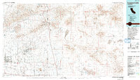
1976 Map of Cuddeback Lake
USGS Topo · Published 1993About this map
Yellow Aster Mine and the Monarch Rand Mine anchor the mining district near the Kern and San Bernardino county line, reflecting the enduring mineral heritage of the western Mojave Desert. This mid-1970s survey illustrates the complex landscape where industrial mining operations at Boron and the high-desert settlements of Randsburg and Johannesburg meet vast military tracts like the Naval Reservation and Edwards Air Force Base. The infrastructure of the region is defined by the Los Angeles Aqueduct cutting across the desert floor and the primary rail corridors of the Southern Pacific and Atchison Topeka and Santa Fe. Numerous dry lake beds, including Cuddeback Lake and Koehn Lake, dominate the low-lying basins between the Rand Mountains and the El Paso Mountains.
Find a feature on this map
68 named features on this map. Tap any name to fly to it.
Don’t see what you’re looking for? This feature index may not catch every label — zoom into the map to look around manually.
Map Details
Editions of this 1976 Cuddeback Lake Map
This is the sole edition of this map. No revisions or reprints were ever made.
Other maps of this area

1903 · Randsburg
USGS Topo · 1:62,500

1906 · Kernville
USGS Topo · 1:125,000

1908 · Kernville
USGS Topo · 1:125,000

1911 · Randsburg
USGS Topo · 1:62,500

1912 · Randsburg
USGS Topo · 1:62,500

1915 · Elizabeth Lake
USGS Topo · 1:125,000

1915 · Searles Lake
USGS Topo · 1:250,000

1915 · Mojave
USGS Topo · 1:125,000

1917 · Elizabeth Lake
USGS Topo · 1:125,000

1932 · Barstow
USGS Topo · 1:125,000