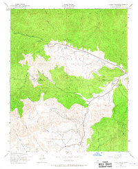
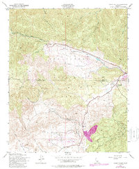
1943 Map of Cuddy Valley
USGS Topo · Published 1967About this map
Cuddy Valley and Lockwood Valley anchor this 1940s survey of the high mountain terrain along the Kern and Ventura county line. The landscape is defined by the extensive Los Padres National Forest, where youth recreation and resource management are clearly established through Camp Trefoil Boy Scout Camp, the San Emigdio Girl Scout Camp, and the Chuchupate Ranger Sta.
Find a feature on this map
24 named features on this map. Tap any name to fly to it.
Don’t see what you’re looking for? This feature index may not catch every label — zoom into the map to look around manually.
Map Details
Editions of this 1943 Cuddy Valley Map
6 editions found
Other maps of this area

1903 · Mt. Pinos
USGS Topo · 1:125,000

1903 · Tejon
USGS Topo · 1:125,000

1942 · Eagle Rest Peak
USGS Topo · 1:24,000

1942 · Tecuya Creek
USGS Topo · 1:24,000

1942 · Frazier Mountain
USGS Topo · 1:24,000

1943 · San Guillermo
USGS Topo · 1:24,000

1943 · Sawmill Mountain
USGS Topo · 1:24,000

1943 · Cuddy Valley
USGS Topo · 1:24,000

1943 · Lockwood Valley
USGS Topo · 1:24,000
1944 · San Guillermo
USGS Topo · 1:31,680