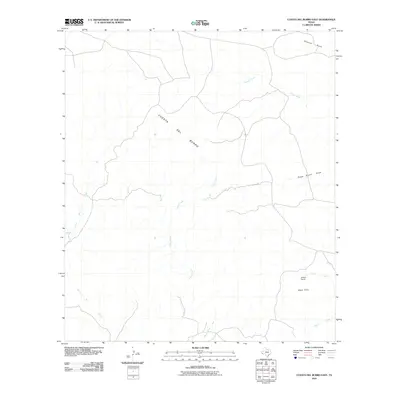
2010 Map of Cuesta Del Burro East
USGS Topo · Published 2010About this map
Cuesta Del Burro dominates the western landscape of this high desert region in Presidio County, marking the transition between the ridge's foothills and the complex drainage systems to the east. This area is defined by a seasonal hydrography that feeds into the Rio Grande basin, including the expansive Cibolo Creek and the meandering Perdiz Creek. Sparse human activity is anchored by the Allison Ranch, located near the Black Hills in the southeastern quadrant, illustrating the traditional ranching heritage that persists in this remote West Texas environment. A network of unimproved roads and drainage patterns, such as Stage Stand Draw and Shannon Draw, trace the paths once utilized for transport and livestock movement across the arid plateau.
Find a feature on this map
10 named features on this map. Tap any name to fly to it.
Don’t see what you’re looking for? This feature index may not catch every label — zoom into the map to look around manually.
Map Details
Editions of this 2010 Cuesta Del Burro East Map
This is the sole edition of this map. No revisions or reprints were ever made.
Other maps of this area

1895 · Marfa
USGS Topo · 1:125,000

1896 · Shafter
USGS Topo · 1:125,000

1959 · Presidio
USGS Topo · 1:250,000

1959 · Marfa
USGS Topo · 1:250,000

1965 · Presidio
USGS Topo · 1:250,000

1965 · Marfa
USGS Topo · 1:250,000
1979 · Chinati Peak
USGS Topo · 1:24,000

1983 · Cuesta Del Burro East
USGS Topo · 1:24,000
1983 · Cuesta Del Burro NW
USGS Topo · 1:24,000
1983 · Cerros Prietos
USGS Topo · 1:24,000