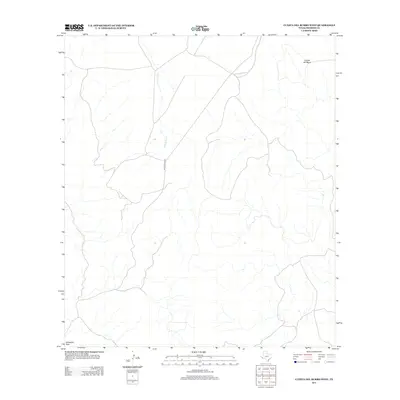
2012 Map of Cuesta Del Burro West
USGS Topo · Published 2012About this map
Cathedral Peak and the high terrain of Cuesta del Burro define this corner of Presidio County in the early 21st century. The map reveals a land structured by topography and water access, where drainage from Wild Horse Cr carves through the arid landscape. Evidence of human passage and ranching utility is concentrated along Pinto Canyon Rd, which serves as the primary artery through this high-desert environment. This survey captures a moment in time before further modern development, showing the essential relationship between the few navigable roads and the natural landmarks that have guided travelers in the Big Bend region for generations.
Find a feature on this map
4 named features on this map. Tap any name to fly to it.
Don’t see what you’re looking for? This feature index may not catch every label — zoom into the map to look around manually.
Map Details
Editions of this 2012 Cuesta Del Burro West Map
This is the sole edition of this map. No revisions or reprints were ever made.
Other maps of this area

1895 · Marfa
USGS Topo · 1:125,000

1896 · Ruidosa
USGS Topo · 1:125,000

1896 · San Carlos
USGS Topo · 1:125,000

1896 · Shafter
USGS Topo · 1:125,000

1959 · Presidio
USGS Topo · 1:250,000

1959 · Marfa
USGS Topo · 1:250,000

1965 · Presidio
USGS Topo · 1:250,000

1965 · Marfa
USGS Topo · 1:250,000

1978 · Sierra Parda
USGS Topo · 1:24,000

1979 · Ruidosa Hot Springs
USGS Topo · 1:24,000