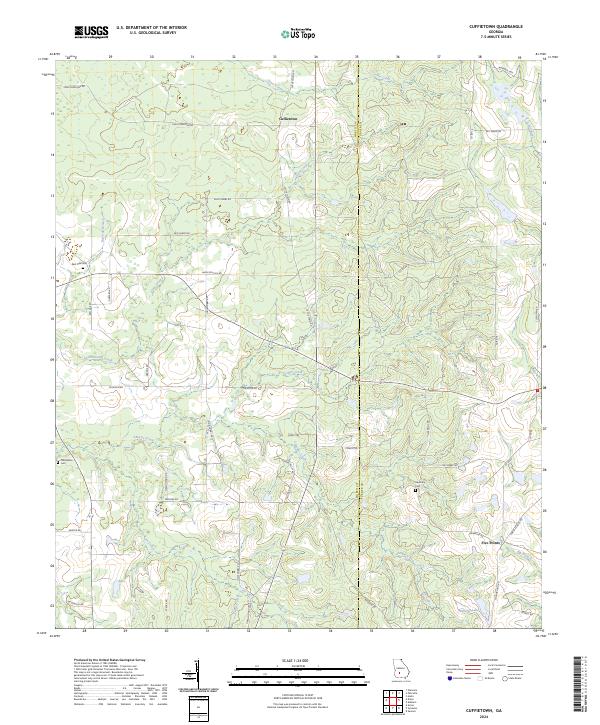
2024 Map of Cuffietown
USGS Topo · Published 2024About this map
Cuffietown and Five Points serve as the primary focal points of this South Georgia landscape, where the border between Worth Co and Turner Co runs through a network of creek drainages and rural homesteads. The terrain is defined by its watercourses, including the Little River on the eastern edge and the meandering paths of Abrams Creek, Gum Creek, and Jones Creek. This modern survey illustrates a landscape of large-scale agriculture and timber, punctuated by small community markers that have persisted over generations.
Find a feature on this map
49 named features on this map. Tap any name to fly to it.
Don’t see what you’re looking for? This feature index may not catch every label — zoom into the map to look around manually.
Map Details
Editions of this 2024 Cuffietown Map
This is the sole edition of this map. No revisions or reprints were ever made.
Other maps of this area

1953 · Waycross
USGS Topo · 1:250,000

1956 · Sylvester
USGS Topo · 1:62,500

1958 · Waycross
USGS Topo · 1:250,000

1972 · Cuffietown
USGS Topo · 1:24,000

1973 · Sumner
USGS Topo · 1:24,000
1973 · Acree
USGS Topo · 1:24,000

1973 · Sylvester
USGS Topo · 1:24,000
1973 · Doles
USGS Topo · 1:24,000

1973 · Ashburn
USGS Topo · 1:24,000
1977 · Arabi
USGS Topo · 1:24,000