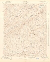
1942 Map of Culberson
USGS Topo · Published 1942About this map
Culberson sits at the northern edge of this 1941 field examination, marking the border where Georgia meets North Carolina. The landscape is defined by the high ridges of Hamstring Mountain and Dividing Ridge, with the Nottely River cutting through the northeast corner. This era shows a distributed rural economy of small mills and local institutions, evidenced by Thomas Mill, McCullough Mill, and Sparks Mill tucked into the creek valleys.
Find a feature on this map
94 named features on this map. Tap any name to fly to it.
Don’t see what you’re looking for? This feature index may not catch every label — zoom into the map to look around manually.
Map Details
Editions of this 1942 Culberson Map
2 editions found
Other maps of this area

1888 · Ellijay
USGS Topo · 1:125,000

1892 · Ellijay
USGS Topo · 1:125,000

1893 · Murphy
USGS Topo · 1:125,000

1898 · Ellijay
USGS Topo · 1:125,000

1911 · Ellijay
USGS Topo · 1:125,000

1914 · Murphy
USGS Topo · 1:125,000

1934 · Murphy
USGS Topo · 1:24,000

1934 · Persimmon Creek
USGS Topo · 1:24,000

1934 · Murphy
USGS Topo · 1:48,000

1935 · Ivylog
USGS Topo · 1:24,000