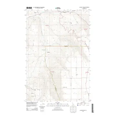
2013 Map of Culdesac South
USGS Topo · Published 2013About this map
Slickpoo and Culdesac are primary focal points in this topographical study of north-central Idaho, where the landscape is defined by the deep incisions of Hamilton Canyon and the surrounding high plateaus. The map documents a complex network of ranching and access roads, including Winchester Grade and Bundy Grade, which navigate the steep elevation changes between the lower canyon floors and ridges like Polly Ridge.
Find a feature on this map
46 named features on this map. Tap any name to fly to it.
Don’t see what you’re looking for? This feature index may not catch every label — zoom into the map to look around manually.
Map Details
Editions of this 2013 Culdesac South Map
This is the sole edition of this map. No revisions or reprints were ever made.
Other maps of this area

1946 · Limekiln Rapids
USGS Topo · 1:62,500

1955 · Pullman
USGS Topo · 1:250,000

1958 · Pullman
USGS Topo · 1:250,000

1958 · Lapwai
USGS Topo · 1:24,000

1958 · Sweetwater
USGS Topo · 1:24,000

1958 · Lewiston Orchards
USGS Topo · 1:62,500

1958 · Culdesac
USGS Topo · 1:62,500
1967 · Winchester East
USGS Topo · 1:24,000

1968 · Waha
USGS Topo · 1:24,000
1968 · Winchester West
USGS Topo · 1:24,000