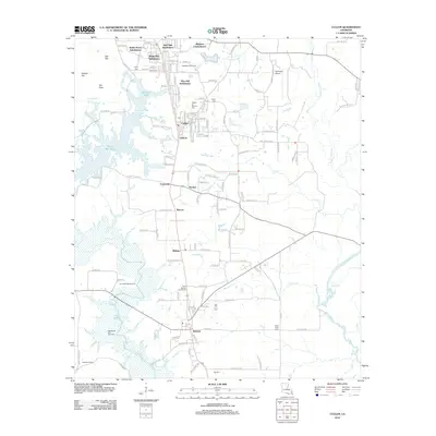
2012 Map of Cullen
USGS Topo · Published 2012About this map
Sarepta and Cullen serve as the primary residential hubs on this northern Louisiana landscape, which is marked by a blend of timbered creek bottoms and active energy production. The industrial character of the region is rooted in its natural resources, evidenced by the Stroud Bridge Oil Field and the Sarepta Oil and Gas Field that dominate the southern portion of the quadrangle. Residential growth is concentrated in several distinct developments north of Cullen, including White Way Subdivision and the Meadow Creek Ranch.
Find a feature on this map
133 named features on this map. Tap any name to fly to it.
Don’t see what you’re looking for? This feature index may not catch every label — zoom into the map to look around manually.
Map Details
Editions of this 2012 Cullen Map
This is the sole edition of this map. No revisions or reprints were ever made.
Other maps of this area

1922 · Sarepta
USGS Topo · 1:62,500

1924 · Sarepta
USGS Topo · 1:62,500

1950 · Plain Dealing NE
USGS Topo · 1:31,680

1950 · Plain Dealing SE
USGS Topo · 1:31,680

1952 · Bradley SE
USGS Topo · 1:24,000

1953 · Carterville
USGS Topo · 1:24,000

1953 · El Dorado
USGS Topo · 1:250,000

1955 · Shreveport
USGS Topo · 1:250,000
1955 · Plain Dealing
USGS Topo · 1:62,500

1956 · Shreveport
USGS Topo · 1:250,000