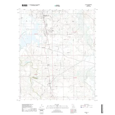
2018 Map of Cullen
USGS Topo · Published 2018About this map
Springhill and Cullen anchor the northern reaches of this Webster Parish landscape, showing a established grid of residential streets and civic sites. The industrial and logistical character of the area is evident in features like Springhill Airport and the large water bodies of Williams Lake and Paper Mill Pond. To the south, the settlement pattern shifts toward rural clusters at Sarepta, Midway, and Porterville, where local history is preserved in numerous family and community burial grounds, including the Saint Moriah Cemeteries and Slack Memorial Cem.
Find a feature on this map
111 named features on this map. Tap any name to fly to it.
Don’t see what you’re looking for? This feature index may not catch every label — zoom into the map to look around manually.
Map Details
Editions of this 2018 Cullen Map
This is the sole edition of this map. No revisions or reprints were ever made.
Other maps of this area

1922 · Sarepta
USGS Topo · 1:62,500

1924 · Sarepta
USGS Topo · 1:62,500

1950 · Plain Dealing NE
USGS Topo · 1:31,680

1950 · Plain Dealing SE
USGS Topo · 1:31,680

1952 · Bradley SE
USGS Topo · 1:24,000

1953 · Carterville
USGS Topo · 1:24,000

1953 · El Dorado
USGS Topo · 1:250,000

1955 · Shreveport
USGS Topo · 1:250,000
1955 · Plain Dealing
USGS Topo · 1:62,500

1956 · Shreveport
USGS Topo · 1:250,000