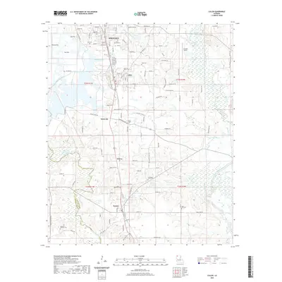
2020 Map of Cullen
USGS Topo · Published 2020About this map
Springhill and Cullen anchor this survey of northern Webster Parish, where the Arkansas-Louisiana state line sits just north of the town centers. The landscape is defined by the winding course of Bayou Dorcheat to the east and Bodcau Creek in the southwest, framing a region of timber and agriculture. Local heritage is deeply rooted in the numerous family and community burial grounds, such as Slack Memorial Cem and Garden of Memory Cem. Small settlements like Sarepta, Midway, and Porterville are connected by a network of local roads including Old Minden Rd and Meadow Creek Dr. Grounded landmarks like Harrison Chapel Cem and Old Sarepta Church Cem mark long-standing community centers in this corner of the Louisiana piney woods.
Find a feature on this map
118 named features on this map. Tap any name to fly to it.
Don’t see what you’re looking for? This feature index may not catch every label — zoom into the map to look around manually.
Map Details
Editions of this 2020 Cullen Map
This is the sole edition of this map. No revisions or reprints were ever made.
Other maps of this area

1922 · Sarepta
USGS Topo · 1:62,500

1924 · Sarepta
USGS Topo · 1:62,500

1950 · Plain Dealing NE
USGS Topo · 1:31,680

1950 · Plain Dealing SE
USGS Topo · 1:31,680

1952 · Bradley SE
USGS Topo · 1:24,000

1953 · Carterville
USGS Topo · 1:24,000

1953 · El Dorado
USGS Topo · 1:250,000

1955 · Shreveport
USGS Topo · 1:250,000
1955 · Plain Dealing
USGS Topo · 1:62,500

1956 · Shreveport
USGS Topo · 1:250,000