
1960 Map of Culleoka
USGS Topo · Published 1962About this map
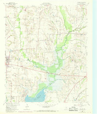
Lavon Reservoir dominates the southern landscape of this 1960 survey, reflecting the mid-century hydrological changes in Collin County. The map captures a rural Texas economy transitioning from traditional farming toward more managed water resources, as seen by the extensive drainage network including Sister Grove Creek and Pilot Grove Creek. For genealogists, the sheet is particularly dense with small community landmarks, such as Henslee Chapel and Verona Ch, alongside several family and community burial grounds like Van Winkle Cem and Hays Cem near the Hays Hills. Transportation history is evident in the Old Railroad Grade cutting across the central plains and the active Gulf Colorado and Santa Fe line in the southeast, while small centers like Princeton and Culleoka anchor the local settlements.
Find a feature on this map
25 named features on this map. Tap any name to fly to it.
Don’t see what you’re looking for? This feature index may not catch every label — zoom into the map to look around manually.
Map Details
Editions of this 1960 Culleoka Map
Other maps of this area

1924 · Farmersville 3-c
USGS Topo · 1:48,000

1924 · Mc Kinney 4-d
USGS Topo · 1:48,000

1929 · McKinney
USGS Topo · 1:62,500

1930 · Farmersville
USGS Topo · 1:62,500

1954 · Sherman
USGS Topo · 1:250,000

1958 · Sherman
USGS Topo · 1:250,000

1959 · Wylie
USGS Topo · 1:24,000

1960 · McKinney East
USGS Topo · 1:24,000

1960 · Blue Ridge
USGS Topo · 1:24,000

1960 · Pike
USGS Topo · 1:24,000