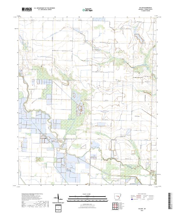
2024 Map of Culler
USGS Topo · Published 2024About this map
Bayou Meto meanders through this agricultural landscape in Lonoke County, defining a region characterized by expansive flatlands like Long Prairie and Buffalo Flat. The survey reveals a highly organized rural grid, where numerous county roads, including Bob Long Rd and Mallard Rd, provide access to the various sections of this fertile river bottom land. The hydrologic network is dense, with several watercourses such as Skinners Branch, Eagle Branch, and the engineered Big Ditch supporting the area's drainage and irrigation needs.
Find a feature on this map
51 named features on this map. Tap any name to fly to it.
Don’t see what you’re looking for? This feature index may not catch every label — zoom into the map to look around manually.
Map Details
Editions of this 2024 Culler Map
This is the sole edition of this map. No revisions or reprints were ever made.
Other maps of this area

1935 · Hazen
USGS Topo · 1:62,500

1937 · Stuttgart
USGS Topo · 1:62,500

1937 · England
USGS Topo · 1:48,000

1939 · Stuttgart
USGS Topo · 1:62,500

1940 · Lonoke
USGS Topo · 1:62,500

1941 · Hazen
USGS Topo · 1:62,500

1943 · England
USGS Topo · 1:62,500

1948 · Helena
USGS Topo · 1:250,000

1949 · Lonoke
USGS Topo · 1:62,500

1950 · Helena
USGS Topo · 1:250,000