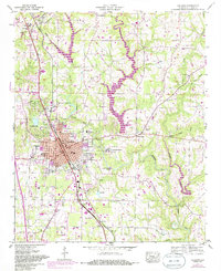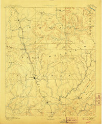
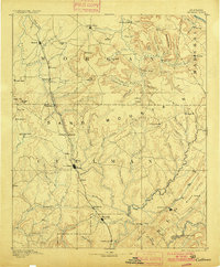
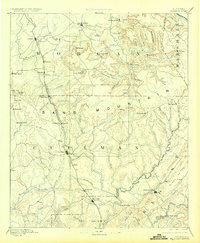
1892 Map of Cullman
USGS Topo · Published 1907About this map
The Louisville and Nashville Railroad serves as the industrial spine of this late 19th-century landscape, connecting a string of settlements from Hartsell and Falkville in the north down to Cullman and Hanceville. This corridor bypasses the complex terrain of Sand Mountain, where the geography is defined by deep gaps and coves like Wilhite Cove and Gandy Cove. The survey illustrates a period when the local economy relied on the intersection of rail transport and water power, evidenced by Sobotka Mill on Shoal Creek and the small post offices scattered throughout the interior.
Find a feature on this map
100 named features on this map. Tap any name to fly to it.
Don’t see what you’re looking for? This feature index may not catch every label — zoom into the map to look around manually.
Map Details
Editions of this 1892 Cullman Map
4 editions found

Historical Maps of Decatur Through Time
9 maps found