
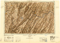
1948 Map of Cumberland
USGS Topo · Published 1948About this map
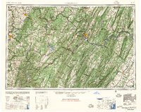
Cumberland serves as the focal point for this post-war regional survey, situated at the convergence of the Potomac River and Wills Creek. The map illustrates the complex ridgeline and valley geography of the Allegheny Mountains and the northern Shenandoah Valley. This era shows a heavy reliance on the rail network, featuring the Baltimore & Ohio RR and Western Maryland Ry threading through narrow water gaps. To the west, the landscape transitions from the industrial centers of Morgantown and Uniontown to the high-elevation recreation area surrounding Deep Creek Lake. In the east, the historic pike towns like Winchester and Berkeley Springs are connected by major highways such as U.S. 11 and U.S. 50, documenting the region's mid-century transportation infrastructure. Large tracts of protected land, including the Monongahela National Forest, indicate the preservation of the central Appalachian highlands.
Find a feature on this map
148 named features on this map. Tap any name to fly to it.
Don’t see what you’re looking for? This feature index may not catch every label — zoom into the map to look around manually.
Map Details
Editions of this 1948 Cumberland Map
3 editions found
Other maps of this area

1884 · Harpers Ferry
USGS Topo · 1:125,000

1886 · St. George
USGS Topo · 1:125,000

1889 · Beverly
USGS Topo · 1:125,000

1891 · Harpers Ferry
USGS Topo · 1:125,000

1891 · St. George
USGS Topo · 1:125,000

1891 · Romney
USGS Topo · 1:125,000

1892 · Beverly
USGS Topo · 1:125,000

1892 · Franklin
USGS Topo · 1:125,000

1892 · Woodstock
USGS Topo · 1:125,000

1893 · Buckhannon
USGS Topo · 1:125,000