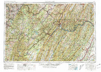
1956 Map of Cumberland
USGS Topo · Published 1981About this map
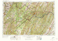
The Potomac River winds through the heart of the Allegheny Mountains, defining the complex border between Maryland and West Virginia in this mid-century survey. Transportation corridors dominate the landscape, following the river valleys and mountain gaps that have historically connected the interior to the coast. The Baltimore & Ohio RR and the Western Maryland RR parallel the water, while the Chesapeake & Ohio Canal traces the northern bank of the Potomac toward Cumberland.
Find a feature on this map
112 named features on this map. Tap any name to fly to it.
Don’t see what you’re looking for? This feature index may not catch every label — zoom into the map to look around manually.
Map Details
Editions of this 1956 Cumberland Map
6 editions found
Other maps of this area

1884 · Harpers Ferry
USGS Topo · 1:125,000

1886 · St. George
USGS Topo · 1:125,000

1889 · Beverly
USGS Topo · 1:125,000

1891 · Harpers Ferry
USGS Topo · 1:125,000

1891 · St. George
USGS Topo · 1:125,000

1891 · Romney
USGS Topo · 1:125,000

1892 · Beverly
USGS Topo · 1:125,000

1892 · Franklin
USGS Topo · 1:125,000

1892 · Woodstock
USGS Topo · 1:125,000

1893 · Buckhannon
USGS Topo · 1:125,000