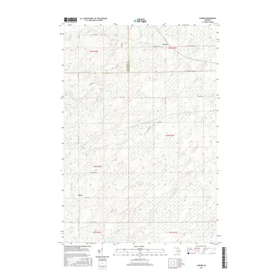
2017 Map of Cunard
USGS Topo · Published 2017About this map
Cunard and Blom serve as the primary focal points of this 2017 survey, which documents the remote drainage systems along the border of Dickinson and Menominee Counties. The landscape is defined by an intricate network of waterways, including the Little Cedar River in the northeast and the winding path of Pemene Cr to the southwest. The presence of numerous named local roads like Snuff Box Road No 42 and Fox Farm Lane P 1 provides a detailed look at the rural infrastructure of Nadeau Township. Water features dominate the map, with smaller tributaries like Faithorn Cr, De Haas Cr, and Camp Two Cr illustrating the region's hydrologic character. This modern topographical record captures the area's transition between managed timberlands and natural wetlands, preserving the local nomenclature of several minor brooks and creeks that have long sustained this section of the Upper Peninsula.
Find a feature on this map
43 named features on this map. Tap any name to fly to it.
Don’t see what you’re looking for? This feature index may not catch every label — zoom into the map to look around manually.
Map Details
Editions of this 2017 Cunard Map
This is the sole edition of this map. No revisions or reprints were ever made.
Other maps of this area

1939 · Pembine
USGS Topo · 1:48,000

1947 · Pembine
USGS Topo · 1:48,000

1954 · Escanaba
USGS Topo · 1:250,000

1955 · Vulcan
USGS Topo · 1:24,000

1955 · Norway
USGS Topo · 1:62,500

1956 · Foster City
USGS Topo · 1:62,500

1957 · Escanaba
USGS Topo · 1:250,000

1958 · Escanaba
USGS Topo · 1:250,000

1963 · Pembine
USGS Topo · 1:62,500

1963 · Powers
USGS Topo · 1:62,500