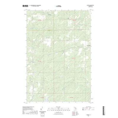
2023 Map of Cunard
USGS Topo · Published 2023About this map
Cunard and Hermansville sit within a landscape defined by the drainage networks of the Upper Peninsula, where the Little Cedar River and numerous tributaries like Faithorn Creek and Pemene Creek carve through the terrain. This modern survey illustrates a region shaped by both agricultural interests, such as the Farm Service Agency Interest of Michigan, and a persistent logging legacy indicated by Logging Rd. Small settlements like Blom are connected by a grid of named rural routes, including Snuff Box Road No 42 and Old US Hwy 2 Road No 43. The map documents the boundary between Dickinson and Menominee counties, reflecting the continued importance of these civil divisions in managing the vast timber and wetland areas that characterize this part of Michigan.
Find a feature on this map
49 named features on this map. Tap any name to fly to it.
Don’t see what you’re looking for? This feature index may not catch every label — zoom into the map to look around manually.
Map Details
Editions of this 2023 Cunard Map
This is the sole edition of this map. No revisions or reprints were ever made.
Other maps of this area

1939 · Pembine
USGS Topo · 1:48,000

1947 · Pembine
USGS Topo · 1:48,000

1954 · Escanaba
USGS Topo · 1:250,000

1955 · Vulcan
USGS Topo · 1:24,000

1955 · Norway
USGS Topo · 1:62,500

1956 · Foster City
USGS Topo · 1:62,500

1957 · Escanaba
USGS Topo · 1:250,000

1958 · Escanaba
USGS Topo · 1:250,000

1963 · Pembine
USGS Topo · 1:62,500

1963 · Powers
USGS Topo · 1:62,500