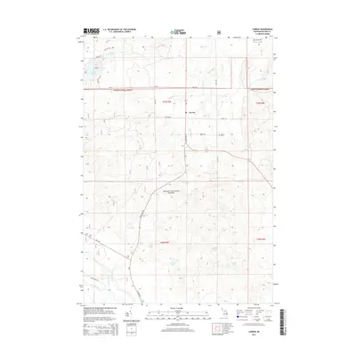
2014 Map of Curran
USGS Topo · Published 2014About this map
Curran serves as the primary settlement within the expansive timberlands of the Huron National Forest. This section of Alcona County is characterized by a dense network of glacial lakes and small creeks, including Hoist Lakes, Byron Lakes, and Penoyer Lake, which drain into the Au Sable River along the southern edge of the survey area. The landscape reflects a mix of forest management and early township development, with roads like M-72 and State Hwy 65 intersecting near the village. Researchers will find the Curran Cem located east of the main junction, while more remote reaches are accessed via forest routes such as Aspen Alley Rd and Red Oak Trl. The map details the transition from the high ground near McFee Lake down to the river valley, illustrating the remote and water-rich geography of the northern Michigan interior.
Find a feature on this map
36 named features on this map. Tap any name to fly to it.
Don’t see what you’re looking for? This feature index may not catch every label — zoom into the map to look around manually.
Map Details
Editions of this 2014 Curran Map
This is the sole edition of this map. No revisions or reprints were ever made.
Other maps of this area

1954 · Tawas City
USGS Topo · 1:250,000

1958 · Tawas City
USGS Topo · 1:250,000

1959 · Glennie
USGS Topo · 1:62,500

1972 · McKinley
USGS Topo · 1:24,000

1972 · Curran
USGS Topo · 1:24,000

1972 · McCollum Lake
USGS Topo · 1:24,000

1972 · Hubbard Lake SW
USGS Topo · 1:24,000

1972 · Goodar
USGS Topo · 1:24,000

1972 · Alcona Dam Pond
USGS Topo · 1:24,000
1972 · McGinn Creek
USGS Topo · 1:24,000