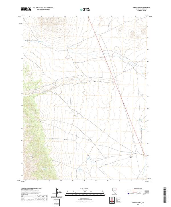
2021 Map of Currie Gardens
USGS Topo · Published 2021About this map
Currie Gardens lies at the base of the eastern slopes of the Cherry Creek Range in this high-desert Nevada landscape. This modern survey illustrates the vital importance of water sources in the arid Steptoe Valley, where numerous isolated water points such as Thompson Springs, Moonshine Spring, and Mustang Springs are documented across the terrain. The landscape is characterized by its dramatic transitions from the alluvial fans of the valley floor to the prominent rising heights of Palomino Ridge.
Find a feature on this map
22 named features on this map. Tap any name to fly to it.
Don’t see what you’re looking for? This feature index may not catch every label — zoom into the map to look around manually.
Map Details
Editions of this 2021 Currie Gardens Map
This is the sole edition of this map. No revisions or reprints were ever made.
Other maps of this area

1955 · Elko
USGS Topo · 1:250,000

1958 · Elko
USGS Topo · 1:250,000

1962 · Elko
USGS Topo · 1:250,000

1965 · Elko
USGS Topo · 1:250,000

1982 · Currie
USGS Topo · 1:24,000

1982 · Mizpah
USGS Topo · 1:24,000
1982 · Goshute Lake North
USGS Topo · 1:24,000

1984 · Currie Gardens
USGS Topo · 1:24,000
1984 · Mt. Taylor
USGS Topo · 1:24,000

1984 · Silo Canyon
USGS Topo · 1:24,000