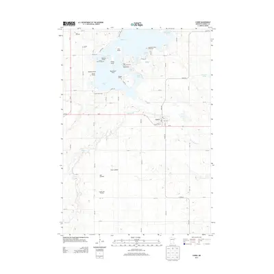
2013 Map of Currie
USGS Topo · Published 2013About this map
Shetek Lake dominates the northern landscape of this Murray County region, where intricate shorelines and numerous islands like Loon Island and Valhalla Island define the local geography. This high-ground plateau, part of the larger Coteau des Prairies, transitions from the recreational waters of the north to the more agrarian, rolling terrain of the south. The village of Currie sits at a geographic pivot point, established where the Des Moines River flows eastward, emerging from the lake's southern reaches. Local history is anchored by sites such as the Currie Pioneer Cem and Bethany Cem, while the presence of Mud Lakebed and Clear Lakebed suggests a dynamic hydrologic history where former wetlands have been reclaimed or naturally receded. The area remains a hub for seasonal activity, evidenced by the clustered campgrounds and the Shetek Church Camp along the lake's western points.
Find a feature on this map
64 named features on this map. Tap any name to fly to it.
Don’t see what you’re looking for? This feature index may not catch every label — zoom into the map to look around manually.
Map Details
Editions of this 2013 Currie Map
This is the sole edition of this map. No revisions or reprints were ever made.
Other maps of this area

1953 · New Ulm
USGS Topo · 1:250,000

1954 · Fairmont
USGS Topo · 1:250,000

1957 · New Ulm
USGS Topo · 1:250,000

1958 · New Ulm
USGS Topo · 1:250,000

1958 · Fairmont
USGS Topo · 1:250,000

1967 · New Ulm
USGS Topo · 1:250,000

1967 · Balaton
USGS Topo · 1:24,000

1967 · Slayton
USGS Topo · 1:24,000

1967 · Tracy East
USGS Topo · 1:24,000

1967 · Hadley
USGS Topo · 1:24,000