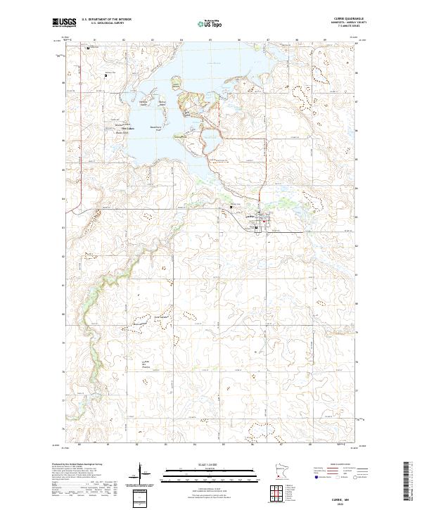
2022 Map of Currie
USGS Topo · Published 2022About this map
The Des Moines River flows through the town of Currie, a focal point of this Murray County landscape. This 2022 survey details a region defined by its diverse glacial water bodies, including the expansive Lake Shetek and its many named landmarks such as Loon Island, Valhalla Island, and Keeley Island. The terrain transitions into the distinct geographic rise of the Coteau des Prairies to the southwest, where the landform shifts toward more open prairie. For researchers, the map identifies several local burial grounds, including the Currie Pioneer Cem and Pioneer Cem near the town center, as well as Bethany Cem and Sarah Cem further north. Recreational and historical paths are documented through the Casey Jones State Trl and Lake Shetek Trails Trl, illustrating the modern use of this lakeside environment.
Find a feature on this map
60 named features on this map. Tap any name to fly to it.
Don’t see what you’re looking for? This feature index may not catch every label — zoom into the map to look around manually.
Map Details
Editions of this 2022 Currie Map
This is the sole edition of this map. No revisions or reprints were ever made.
Other maps of this area

1953 · New Ulm
USGS Topo · 1:250,000

1954 · Fairmont
USGS Topo · 1:250,000

1957 · New Ulm
USGS Topo · 1:250,000

1958 · New Ulm
USGS Topo · 1:250,000

1958 · Fairmont
USGS Topo · 1:250,000

1967 · New Ulm
USGS Topo · 1:250,000

1967 · Balaton
USGS Topo · 1:24,000

1967 · Slayton
USGS Topo · 1:24,000

1967 · Tracy East
USGS Topo · 1:24,000

1967 · Hadley
USGS Topo · 1:24,000