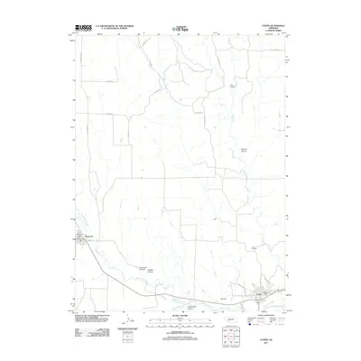
2011 Map of Curtis
USGS Topo · Published 2011About this map
Medicine Creek winds through the southern portion of this Frontier County landscape, carving a series of deep drainages including Cottonwood Canyon and Aakenson Canyon. The settlement of Curtis serves as the primary hub in the southeast, where the Curtis Post Office and Curtis Cemetery anchor the community. Further west, Maywood marks the western boundary of the quadrangle with its own Maywood Post Office. The terrain is defined by a dendritic network of seasonal washes and creek beds, most notably Fox Creek and its many branches like Cut Canyon and Richman Canyon to the north. A structured rural road network, featuring routes such as S Zwickle Rd and E Wells Rd, connects these isolated homesteads and agricultural tracts across the high plains north of Cole Dam.
Find a feature on this map
28 named features on this map. Tap any name to fly to it.
Don’t see what you’re looking for? This feature index may not catch every label — zoom into the map to look around manually.
Map Details
Editions of this 2011 Curtis Map
This is the sole edition of this map. No revisions or reprints were ever made.
Other maps of this area

1902 · Gothenburg
USGS Topo · 1:125,000

1954 · McCook
USGS Topo · 1:250,000

1956 · Jeffrey Reservoir SW
USGS Topo · 1:24,000

1956 · Curtis SW
USGS Topo · 1:24,000

1956 · Moorefield
USGS Topo · 1:24,000

1956 · Curtis NW
USGS Topo · 1:24,000

1956 · Curtis
USGS Topo · 1:24,000

1956 · Curtis SE
USGS Topo · 1:24,000

1956 · Stockville
USGS Topo · 1:24,000

1956 · Wellfleet SE
USGS Topo · 1:24,000