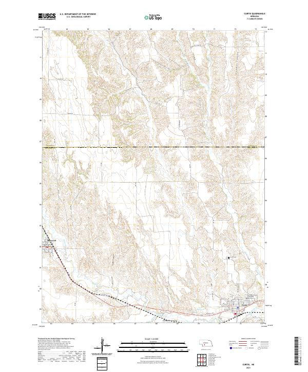
2021 Map of Curtis
USGS Topo · Published 2021About this map
Curtis and Maywood serve as the primary population centers in this Frontier County landscape, where the high plains are deeply incised by a network of drainage canyons. The Nebraska College of Technical Agriculture is a prominent institution on the eastern edge of Curtis, situated near the banks of Medicine Cr. The terrain is defined by rugged eroded features such as Richman Canyon, Cut Canyon, and Staples Canyon, which reveal the complex hydrology of the region before water reaches Cole Reservoir. Transportation is dictated by these landforms, with routes like State Hwy 23 and Sandhills Rd navigating the divides between the canyon floors and the upland plateaus. Local history is anchored by sites like Curtis Cem, providing a focal point for genealogical research in this rural Nebraska community.
Find a feature on this map
44 named features on this map. Tap any name to fly to it.
Don’t see what you’re looking for? This feature index may not catch every label — zoom into the map to look around manually.
Map Details
Editions of this 2021 Curtis Map
This is the sole edition of this map. No revisions or reprints were ever made.
Other maps of this area

1902 · Gothenburg
USGS Topo · 1:125,000

1954 · McCook
USGS Topo · 1:250,000

1956 · Jeffrey Reservoir SW
USGS Topo · 1:24,000

1956 · Curtis SW
USGS Topo · 1:24,000

1956 · Moorefield
USGS Topo · 1:24,000

1956 · Curtis NW
USGS Topo · 1:24,000

1956 · Curtis
USGS Topo · 1:24,000

1956 · Curtis SE
USGS Topo · 1:24,000

1956 · Stockville
USGS Topo · 1:24,000

1956 · Wellfleet SE
USGS Topo · 1:24,000