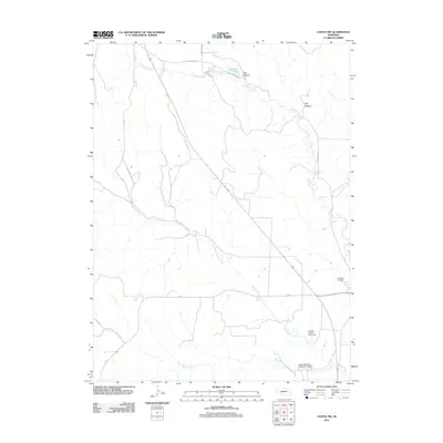
2011 Map of Curtis NW
USGS Topo · Published 2011About this map
Medicine Creek winds through this rural portion of Frontier County, cutting a path through the Nebraska landscape northwest of Maywood. The map highlights the localized water management systems typical of the Great Plains, featuring infrastructure like Upper Medicine Creek Dam 390-B and Brushy Creek Dam 410. These features, along with Farmers Lake and the feeder waters of North Brushy Creek, illustrate the vital role of water conservation in this agricultural region. On the eastern edge of the survey, the Maywood Cemetery serves as a primary point of interest for genealogists tracing local families. The terrain is defined by several prominent drainages, including Lake Canyon and Hay Canyon, which break the upland plateaus and provide natural landmarks for navigating this stretch of the county.
Find a feature on this map
19 named features on this map. Tap any name to fly to it.
Don’t see what you’re looking for? This feature index may not catch every label — zoom into the map to look around manually.
Map Details
Editions of this 2011 Curtis NW Map
This is the sole edition of this map. No revisions or reprints were ever made.
Other maps of this area

1954 · McCook
USGS Topo · 1:250,000

1956 · White NE
USGS Topo · 1:24,000

1956 · Curtis SW
USGS Topo · 1:24,000

1956 · Curtis NW
USGS Topo · 1:24,000

1956 · Curtis
USGS Topo · 1:24,000

1956 · Somerset
USGS Topo · 1:24,000

1956 · Curtis SE
USGS Topo · 1:24,000

1956 · Wellfleet SE
USGS Topo · 1:24,000

1956 · Wellfleet
USGS Topo · 1:24,000

1957 · McCook
USGS Topo · 1:250,000