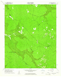
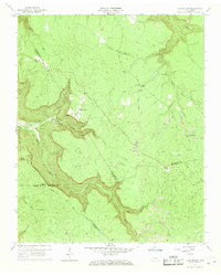
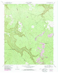
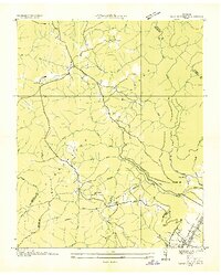
1960 Map of Curtistown
USGS Topo · Published 1961About this map
The Plateau terrain where the boundaries of Warren, Van Buren, Grundy, and Sequatchie counties converge defines this 1960 landscape. Rural life centers on the small settlement of Curtistown, while Chalybeate lies further east along the Rocky River. The map captures a transitional period for local industry, evidenced by numerous Strip Mines and a Strip Mine site near the river. Genealogical interest is anchored at Pleasant Hill Cem, located near the intersection of various unimproved roads and trails.
Find a feature on this map
37 named features on this map. Tap any name to fly to it.
Don’t see what you’re looking for? This feature index may not catch every label — zoom into the map to look around manually.
Map Details
Editions of this 1960 Curtistown Map
3 editions found
Other maps of this area

1888 · Chattanooga
USGS Topo · 1:125,000

1892 · Pikeville
USGS Topo · 1:125,000

1893 · Mc Minnville
USGS Topo · 1:125,000

1893 · Chattanooga
USGS Topo · 1:125,000

1895 · Mc Minnville
USGS Topo · 1:125,000

1895 · Sewanee
USGS Topo · 1:125,000

1895 · Pikeville
USGS Topo · 1:125,000
1935 · Smart Mountain
USGS Topo · 1:24,000
1936 · Savage Point
USGS Topo · 1:24,000
1946 · Savage Point
USGS Topo · 1:24,000