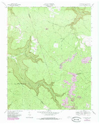
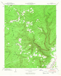
1960 Map of Curtistown
USGS Topo · Published 1985About this map
Curtistown and the surrounding high country of the Cumberland Plateau are defined by sharp topographic relief and the intricate drainage basins of the Rocky River. This 1960s landscape, later updated with mid-1980s land-use data, illustrates a region where small mountain settlements like Chalybeate exist alongside early scientific and industrial footprints. The Cumberland Plateau Observatory stands on a ridge, while the southern reaches of the map show the visible impact of extractive industries through Strip Mines.
Find a feature on this map
35 named features on this map. Tap any name to fly to it.
Don’t see what you’re looking for? This feature index may not catch every label — zoom into the map to look around manually.
Map Details
Editions of this 1960 Curtistown Map
3 editions found
Other maps of this area

1888 · Chattanooga
USGS Topo · 1:125,000

1892 · Pikeville
USGS Topo · 1:125,000

1893 · Mc Minnville
USGS Topo · 1:125,000

1893 · Chattanooga
USGS Topo · 1:125,000

1895 · Mc Minnville
USGS Topo · 1:125,000

1895 · Sewanee
USGS Topo · 1:125,000

1895 · Pikeville
USGS Topo · 1:125,000

1935 · Smart Mountain
USGS Topo · 1:24,000
1936 · Savage Point
USGS Topo · 1:24,000
1946 · Savage Point
USGS Topo · 1:24,000