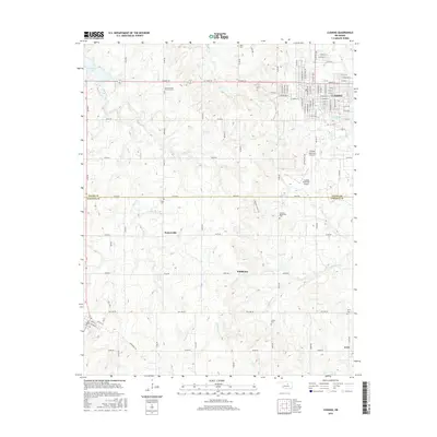
2016 Map of Cushing
USGS Topo · Published 2016About this map
Cushing serves as the primary urban center in this 2016 survey, where the grid of city streets like W Broadway St and E Main St transitions into the rural reaches of Payne and Lincoln Counties. The landscape is defined by its numerous small burial grounds and rural communities, including the dispersed settlements of Soonerville, Wildhorse, and Avery. Local genealogy is well-documented through several dedicated sites, such as Union Cem, Flynn Cem, and the Church of the Brethren Cem. To the northwest, Cushing Lake provides a significant water feature, while the Cushing Municipal Airport occupies a large tract of land south of the city. The drainage network is complex, with Cottonwood Cr and Wildhorse Cr winding through the rolling terrain, reflecting the agricultural and topographical character of this Oklahoma region in the mid-2010s.
Find a feature on this map
68 named features on this map. Tap any name to fly to it.
Don’t see what you’re looking for? This feature index may not catch every label — zoom into the map to look around manually.
Map Details
Editions of this 2016 Cushing Map
This is the sole edition of this map. No revisions or reprints were ever made.
Other maps of this area

1908 · Agra
USGS Topo · 1:62,500

1929 · Yale
USGS Topo · 1:62,500

1929 · Ripley
USGS Topo · 1:62,500

1931 · Drumright
USGS Topo · 1:62,500

1932 · Yale
USGS Topo · 1:62,500

1932 · Ripley
USGS Topo · 1:62,500

1954 · Oklahoma City
USGS Topo · 1:250,000

1955 · Enid
USGS Topo · 1:250,000

1957 · Oklahoma City
USGS Topo · 1:250,000

1958 · Enid
USGS Topo · 1:250,000