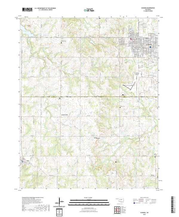
2022 Map of Cushing
USGS Topo · Published 2022About this map
Cushing serves as the primary hub in this portion of Oklahoma, where the street grid expands into a series of rural communities and homesteads. The landscape is defined by the crossing of the Payne Co Lincoln Co line, separating the northern developed areas from the more dispersed settlements to the south. Numerous small family and denominational burial sites, such as the Church of the Brethren Cem, Flynn Cem, and Lutheran Cem, are scattered throughout the countryside, often located near intersections or small watercourses like Big Creek and Cabin Cr. This distribution suggests a history of localized rural neighborhoods centered around these communal points. Further south, the map reveals the smaller outposts of Soonerville, Wildhorse, and Avery, connected by a network of sectional roads. Drainage patterns from Wildhorse Cr and Cottonwood Cr dictate the topography, influencing the placement of local infrastructure and the Cushing Municipal Airport.
Find a feature on this map
66 named features on this map. Tap any name to fly to it.
Don’t see what you’re looking for? This feature index may not catch every label — zoom into the map to look around manually.
Map Details
Editions of this 2022 Cushing Map
This is the sole edition of this map. No revisions or reprints were ever made.
Other maps of this area

1908 · Agra
USGS Topo · 1:62,500

1929 · Yale
USGS Topo · 1:62,500

1929 · Ripley
USGS Topo · 1:62,500

1931 · Drumright
USGS Topo · 1:62,500

1932 · Yale
USGS Topo · 1:62,500

1932 · Ripley
USGS Topo · 1:62,500

1954 · Oklahoma City
USGS Topo · 1:250,000

1955 · Enid
USGS Topo · 1:250,000

1957 · Oklahoma City
USGS Topo · 1:250,000

1958 · Enid
USGS Topo · 1:250,000