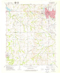
1975 Map of Cushing
USGS Topo · Published 1979About this map
The massive Oil Field and extensive Tank Farm east of Cushing dominate the landscape of the mid-1970s, reflecting the region's enduring identity as a petroleum hub. This survey documents the complex industrial infrastructure of the era, from the Refinery and Substation to the web of pipelines connecting the central town to the surrounding countryside. Beyond the industrial core, the map captures a rural social fabric maintained through landmarks like the Lone Oak Community Hall, the Church of the Brethren, and scattered country burial grounds including Union Cem and Smith Cem. Transport networks are prominently featured, showing the Missouri-Kansas-Texas and Atchison Topeka and Santa Fe railroads alongside the Cushing Municipal Airport. These rails and roads skirt the drainage of Cimarron and Wildhorse Creek, providing a detailed view of the terrain before further modern development altered the rural routes between Agra and Avery.
Find a feature on this map
42 named features on this map. Tap any name to fly to it.
Don’t see what you’re looking for? This feature index may not catch every label — zoom into the map to look around manually.
Map Details
Editions of this 1975 Cushing Map
This is the sole edition of this map. No revisions or reprints were ever made.
Other maps of this area

1908 · Agra
USGS Topo · 1:62,500

1929 · Yale
USGS Topo · 1:62,500

1929 · Ripley
USGS Topo · 1:62,500

1931 · Drumright
USGS Topo · 1:62,500

1932 · Yale
USGS Topo · 1:62,500

1932 · Ripley
USGS Topo · 1:62,500

1954 · Oklahoma City
USGS Topo · 1:250,000

1955 · Enid
USGS Topo · 1:250,000

1957 · Oklahoma City
USGS Topo · 1:250,000

1958 · Enid
USGS Topo · 1:250,000