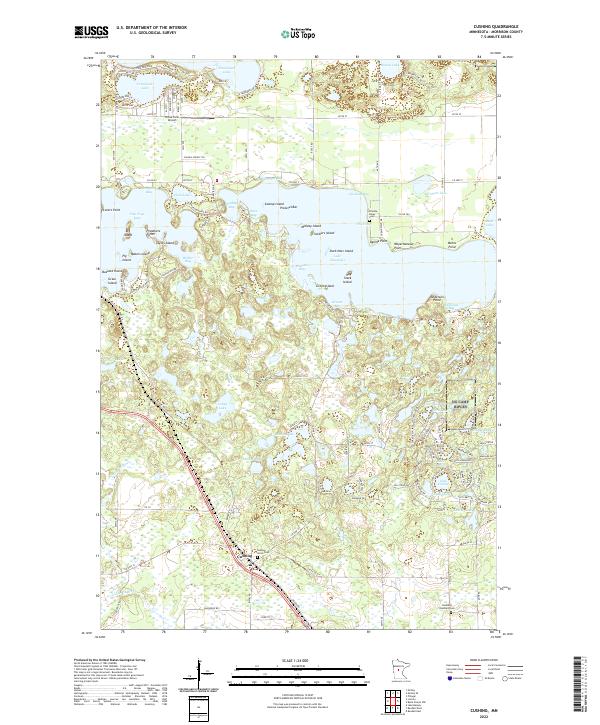
2022 Map of Cushing
USGS Topo · Published 2022About this map
The settlement of Cushing sits as a central hub in this lake-rich portion of Morrison County, positioned along the BNSF Railway and the Little Elk River. This landscape is defined by its intricate glacial topography, where numerous water bodies like Lake Alexander, Fish Trap Lake, and Shamineau Lake are interconnected by complex shorelines and named points. Cultural landmarks are scattered throughout the rural landscape, including the Cushing Union Cemetery near the town site and the Scandia Valley Cemetery further north. The map reveals a mixture of seasonal and permanent residency through the dense network of local roads such as Island View Dr and Hohler Bay Dr, which provide access to numerous islands and bays. A sense of the local economy and infrastructure is provided by features like the Hines Farm Airport and the expansive rail line that cuts through the southern terrain.
Find a feature on this map
97 named features on this map. Tap any name to fly to it.
Don’t see what you’re looking for? This feature index may not catch every label — zoom into the map to look around manually.
Map Details
Editions of this 2022 Cushing Map
This is the sole edition of this map. No revisions or reprints were ever made.
Other maps of this area

1916 · Pillager
USGS Topo · 1:62,500

1919 · Pillager
USGS Topo · 1:62,500

1948 · Belle Prairie
USGS Topo · 1:62,500

1948 · Cushing
USGS Topo · 1:62,500

1950 · Belle Prairie
USGS Topo · 1:62,500

1950 · Cushing
USGS Topo · 1:62,500

1953 · Brainerd
USGS Topo · 1:250,000

1954 · Pillager
USGS Topo · 1:24,000
1956 · Belle Prairie NW
USGS Topo · 1:24,000
1956 · Randall
USGS Topo · 1:24,000