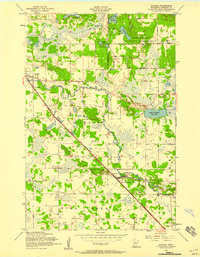
1956 Map of Randall
USGS Topo · Published 1958About this map
The Northern Pacific railroad cuts a straight diagonal across this mid-century landscape, linking the village of Randall to the surrounding rural townships of Clough, Darling, and Pike Creek. The Elk River meanders through the center of the sheet, its oxbows and marshy banks contrasting with the structured grid of sections and local roads like Argonne Road and Champange Road. A significant portion of the northeast quadrant is dedicated to the Camp Ripley Military Reservation, while the remainder of the area is dotted with small-scale agricultural landmarks, including several rural schoolhouses such as School No 57 and School No 74. Genealogists will find particular value in the clearly marked St James Cemetery and the Old Darling Mission Cemetery, which sit near the Immanuel Church as markers of the community's early social and religious foundations.
Find a feature on this map
43 named features on this map. Tap any name to fly to it.
Don’t see what you’re looking for? This feature index may not catch every label — zoom into the map to look around manually.
Map Details
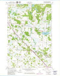
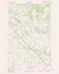
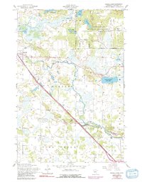
Editions of this 1956 Randall Map
4 editions found
Historical Maps of Randall Through Time
No other maps found