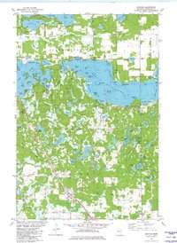
1981 Map of Cushing
USGS Topo · Published 1982About this map
The lake-strewn landscape of Morrison County is defined here by the irregular shorelines of Lake Alexander, Fish Trap Lake, and Shamineau Lake. The settlement of Cushing sits in the southern portion of the sheet along the Burlington Northern railroad, serving as a focal point for the surrounding rural area. To the north, the township of Scandia Valley encompasses numerous named islands and bays, such as Soldiers Island and Goodwin Bay, reflecting a region deeply tied to its water bodies.
Find a feature on this map
72 named features on this map. Tap any name to fly to it.
Don’t see what you’re looking for? This feature index may not catch every label — zoom into the map to look around manually.
Map Details
Editions of this 1981 Cushing Map
This is the sole edition of this map. No revisions or reprints were ever made.
Other maps of this area

1916 · Pillager
USGS Topo · 1:62,500

1919 · Pillager
USGS Topo · 1:62,500

1948 · Belle Prairie
USGS Topo · 1:62,500

1948 · Cushing
USGS Topo · 1:62,500

1950 · Belle Prairie
USGS Topo · 1:62,500

1950 · Cushing
USGS Topo · 1:62,500

1953 · Brainerd
USGS Topo · 1:250,000

1954 · Pillager
USGS Topo · 1:24,000
1956 · Belle Prairie NW
USGS Topo · 1:24,000
1956 · Randall
USGS Topo · 1:24,000