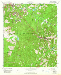
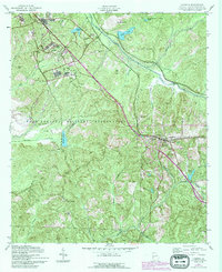
1955 Map of Cusseta
USGS Topo · Published 1964About this map
Cusseta stands at a critical junction of mid-century infrastructure, where the Seaboard Central of Georgia Line and Seaboard Air Line railroads converge amidst the expansive Fort Benning Military Reservation. This survey captures the rural character of Chattahoochee County during its Cold War-era expansion, balancing military development with established local landmarks. The northern portion of the sheet is dominated by a complex of military infrastructure, including a prominent Hospital and numerous named hills like Reeve Hill and Ray Hill.
Find a feature on this map
38 named features on this map. Tap any name to fly to it.
Don’t see what you’re looking for? This feature index may not catch every label — zoom into the map to look around manually.
Map Details
Editions of this 1955 Cusseta Map
5 editions found
Other maps of this area

1908 · Columbus
USGS Topo · 1:62,500

1929 · Columbus
USGS Topo · 1:48,000

1947 · Columbus
USGS Topo · 1:62,500

1949 · Glen Alta
USGS Topo · 1:24,000

1949 · Julia
USGS Topo · 1:24,000

1949 · Ochillee
USGS Topo · 1:24,000

1949 · Buena Vista NW
USGS Topo · 1:24,000

1949 · Columbus
USGS Topo · 1:24,000

1949 · Cusseta
USGS Topo · 1:24,000

1950 · Fort Benning
USGS Topo · 1:24,000