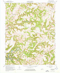
1963 Map of Custer
USGS Topo · Published 1977About this map
Rough River Lake dominates the southern half of this landscape, its controlled waters reaching deep into the Ivory Prong and Clear Prong valleys. The terrain is a network of ridges and hollows, where family-named landmarks like Marks Ridge and Duncan Valley provide geographical context for several small farming communities. Settled crossroads such as Hudson, Custer, and Locust Hill serve as anchor points for rural life, connected by winding country roads that follow the natural contours of the land.
Find a feature on this map
48 named features on this map. Tap any name to fly to it.
Don’t see what you’re looking for? This feature index may not catch every label — zoom into the map to look around manually.
Map Details
Editions of this 1963 Custer Map
2 editions found
Other maps of this area

1928 · Hardinsburg
USGS Topo · 1:48,000

1931 · Hardinsburg
USGS Topo · 1:62,500

1932 · Big Clifty
USGS Topo · 1:62,500

1941 · Ekron
USGS Topo · 1:62,500

1947 · Hardinsburg
USGS Topo · 1:24,000

1947 · Garfield
USGS Topo · 1:24,000

1947 · Hardinsburg
USGS Topo · 1:62,500

1947 · Ekron
USGS Topo · 1:62,500
1948 · Big Spring
USGS Topo · 1:24,000

1949 · Constantine
USGS Topo · 1:24,000