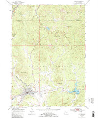
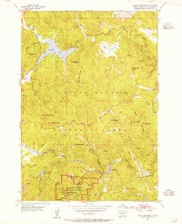
1954 Map of Custer
USGS Topo · Published 1966About this map
Custer sits at the heart of this mid-century survey, serving as a hub for the rail and road networks that penetrate the surrounding Black Hills National Forest. The map documents a significant era of transition for the region, where the industrial legacy of the Clara Belle Mine and Wild Rose Mine meets the burgeoning tourism of the 1950s. High-elevation landmarks like the Harney Peak Lookout Tower and The Needles overlook the winding Needles Highway. A particularly notable feature is Thunderhead Mountain, which is labeled with its developing monument. Along the southern edge of town, the presence of a Drive-in Theater and Stockade Lake recreation areas contrast with the working lines of the Chicago Burlington and Quincy railroad, illustrating the dual nature of this mountain landscape.
Find a feature on this map
39 named features on this map. Tap any name to fly to it.
Don’t see what you’re looking for? This feature index may not catch every label — zoom into the map to look around manually.
Map Details
Editions of this 1954 Custer Map
5 editions found
Other maps of this area

1894 · Hermosa
USGS Topo · 1:125,000

1896 · Harney Peak
USGS Topo · 1:125,000

1901 · Hermosa
USGS Topo · 1:125,000

1901 · Harney Peak
USGS Topo · 1:125,000

1954 · Iron Mountain
USGS Topo · 1:24,000

1954 · Fourmile
USGS Topo · 1:24,000
1954 · Mount Rushmore
USGS Topo · 1:24,000

1954 · Custer
USGS Topo · 1:24,000

1954 · Hill City
USGS Topo · 1:24,000

1954 · Berne
USGS Topo · 1:24,000