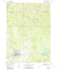
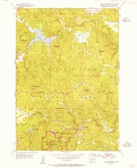
1954 Map of Custer
USGS Topo · Published 1988About this map
Custer serves as the focal point of this mid-century survey, situated at the confluence of French Creek and Laughing Water Creek. The landscape is dominated by the granite formations of the Black Hills National Forest, featuring the massive Thunderhead Mountain Crazy Horse Carving and the Harney Peak Lookout Tower. This era of the 1950s shows a balance between traditional resource extraction and the region's burgeoning status as a destination, evidenced by the Chicago Burlington and Quincy railroad line running alongside modern developments like a Drive-in Theater.
Find a feature on this map
41 named features on this map. Tap any name to fly to it.
Don’t see what you’re looking for? This feature index may not catch every label — zoom into the map to look around manually.
Map Details
Editions of this 1954 Custer Map
5 editions found
Other maps of this area

1894 · Hermosa
USGS Topo · 1:125,000

1896 · Harney Peak
USGS Topo · 1:125,000

1901 · Hermosa
USGS Topo · 1:125,000

1901 · Harney Peak
USGS Topo · 1:125,000

1954 · Iron Mountain
USGS Topo · 1:24,000

1954 · Fourmile
USGS Topo · 1:24,000
1954 · Mount Rushmore
USGS Topo · 1:24,000

1954 · Custer
USGS Topo · 1:24,000

1954 · Hill City
USGS Topo · 1:24,000

1954 · Berne
USGS Topo · 1:24,000