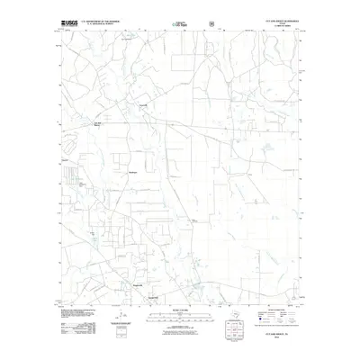
2010 Map of Cut And Shoot
USGS Topo · Published 2010About this map
Cut and Shoot serves as the focal point of this Montgomery County landscape, situated at the intersection of Old State Hwy 105 and Waukegan Rd. The area is characterized by a series of distinct smaller communities and settlements, including Waukegan, Groceville, and Grangerland, which are connected by a network of rural routes like FM 1484 Rd and FM 3083 Rd. The hydrology of the region is defined by the branching paths of Caney Creek and the West Fork Crystal Creek, while Crater Lake and Crater Hill provide a unique geological footprint in the southwestern portion of the quadrangle. Several man-made water features, such as Bart Lake and Lake Wildwood, suggest local residential or recreational developments. The map provides a detailed look at the 2010 distribution of property-defining roads and named branches, such as Milam Branch and Cagle Branch, that have long dictated the layout of these East Texas communities.
Find a feature on this map
66 named features on this map. Tap any name to fly to it.
Don’t see what you’re looking for? This feature index may not catch every label — zoom into the map to look around manually.
Map Details
Editions of this 2010 Cut And Shoot Map
This is the sole edition of this map. No revisions or reprints were ever made.
Other maps of this area

1954 · Beaumont
USGS Topo · 1:250,000

1957 · Beaumont
USGS Topo · 1:250,000

1958 · Conroe
USGS Topo · 1:24,000

1958 · Fostoria
USGS Topo · 1:24,000

1958 · Bear Creek
USGS Topo · 1:24,000

1959 · Outlaw Pond
USGS Topo · 1:24,000

1959 · Cut and Shoot
USGS Topo · 1:24,000

1959 · Conroe NE
USGS Topo · 1:24,000
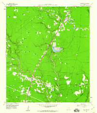
1959 · Splendora
USGS Topo · 1:24,000

1960 · Willis
USGS Topo · 1:24,000