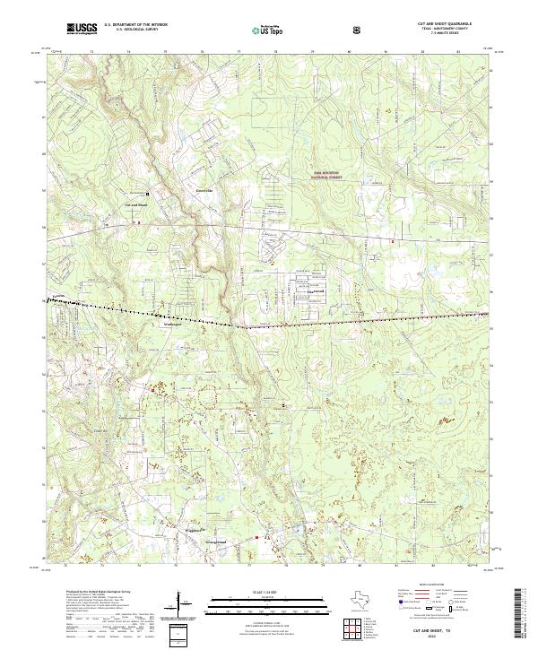
2022 Map of Cut And Shoot
USGS Topo · Published 2022About this map
Groceville and the distinctively named Cut and Shoot anchor the northern landscape of this Montgomery County survey, where the dense woodlands of the Sam Houston National Forest meet a network of small residential clusters. The terrain is defined by the winding paths of Caney Cr and Crystal Cr, creating a complex drainage system that supports Lake Wildwood and Crater Lake. To the south, the settlements of Waukegan and Grangerland reveal a transition toward more concentrated development along major thoroughfares like Waukegan Rd.
Find a feature on this map
170 named features on this map. Tap any name to fly to it.
Don’t see what you’re looking for? This feature index may not catch every label — zoom into the map to look around manually.
Map Details
Editions of this 2022 Cut And Shoot Map
This is the sole edition of this map. No revisions or reprints were ever made.
Other maps of this area

1954 · Beaumont
USGS Topo · 1:250,000

1957 · Beaumont
USGS Topo · 1:250,000

1958 · Conroe
USGS Topo · 1:24,000

1958 · Fostoria
USGS Topo · 1:24,000

1958 · Bear Creek
USGS Topo · 1:24,000

1959 · Outlaw Pond
USGS Topo · 1:24,000

1959 · Cut and Shoot
USGS Topo · 1:24,000

1959 · Conroe NE
USGS Topo · 1:24,000
1959 · Splendora
USGS Topo · 1:24,000

1960 · Willis
USGS Topo · 1:24,000