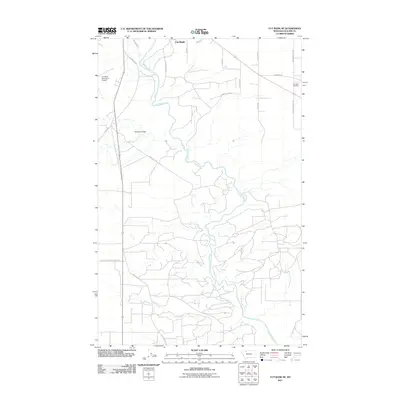
2011 Map of Cut Bank SE
USGS Topo · Published 2011About this map
Cut Bank Creek carves a winding path through the Glacier County landscape, defining the topography south of the town of Cut Bank. The 2011 survey documents a mix of industrial infrastructure and rural land use, anchored by the Cut Bank Refinery in the northeast and the Cut Bank Municipal Airport to the west. This area exhibits a transition from aviation and refinery operations to the open range of Spring Coulee.
Find a feature on this map
23 named features on this map. Tap any name to fly to it.
Don’t see what you’re looking for? This feature index may not catch every label — zoom into the map to look around manually.
Map Details
Editions of this 2011 Cut Bank SE Map
This is the sole edition of this map. No revisions or reprints were ever made.
Other maps of this area

1907 · Blackfoot Res.
USGS Topo · 1:48,000

1909 · Cut Bank
USGS Topo · 1:125,000

1912 · Cut Bank
USGS Topo · 1:125,000

1920 · Dupuyer
USGS Topo · 1:125,000

1934 · Lake Frances
USGS Topo · 1:48,000

1934 · Valier
USGS Topo · 1:62,500

1937 · Valier
USGS Topo · 1:62,500

1937 · Lake Frances
USGS Topo · 1:62,500

1960 · Cut Bank
USGS Topo · 1:250,000

1963 · Cut Bank
USGS Topo · 1:250,000