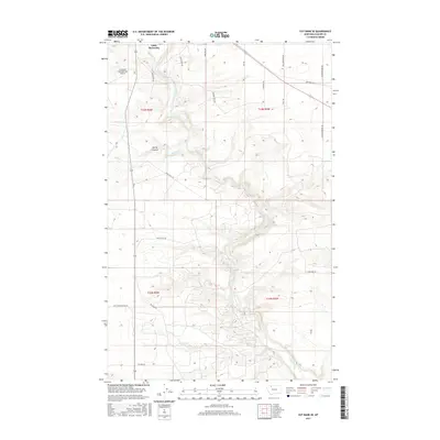
2017 Map of Cut Bank SE
USGS Topo · Published 2017About this map
Cut Bank Creek winds south through this high-plains landscape in Glacier County, carving a distinctive drainage pattern that defines the local geography. Near the northern boundary, the settlement of Little Browning sits above the creek valley, while the Cut Bank International Airport occupies the level ground to the west. The map reveals a network of rural roads often named for local families or landmarks, such as Raemaeker Rd, Hole Brothers Rd, and Sullivan Bridge Rd. Evidence of the region's agricultural and industrial infrastructure is visible in routes like Refinery Rd and Camp Nine RD. The southern portion of the quadrangle is marked by Spring Coulee and the meandering Spring Cr, showing the transition from open grazing land to the more complex topography near the Gov Hugo Aronson Rd corridor.
Find a feature on this map
25 named features on this map. Tap any name to fly to it.
Don’t see what you’re looking for? This feature index may not catch every label — zoom into the map to look around manually.
Map Details
Editions of this 2017 Cut Bank SE Map
This is the sole edition of this map. No revisions or reprints were ever made.
Other maps of this area

1907 · Blackfoot Res.
USGS Topo · 1:48,000

1909 · Cut Bank
USGS Topo · 1:125,000

1912 · Cut Bank
USGS Topo · 1:125,000

1920 · Dupuyer
USGS Topo · 1:125,000

1934 · Lake Frances
USGS Topo · 1:48,000

1934 · Valier
USGS Topo · 1:62,500

1937 · Valier
USGS Topo · 1:62,500

1937 · Lake Frances
USGS Topo · 1:62,500

1960 · Cut Bank
USGS Topo · 1:250,000

1963 · Cut Bank
USGS Topo · 1:250,000