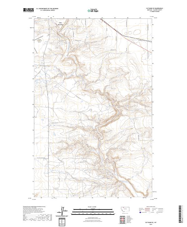
2024 Map of Cut Bank SE
USGS Topo · Published 2024About this map
Little Browning sits in the northwest corner of this Glacier County landscape, where the high plains meet the intricate drainage systems of the Blackfeet Indian Reservation. The terrain is defined by the deep, winding course of Cut Bank Creek, which carves a complex path through the center of the sheet, joined by Spring Creek and the notable Spring Coulee. This modern survey illustrates the intersection of traditional land divisions and contemporary infrastructure, with the Cut Bank International Airport serving as a significant landmark on the western plateau.
Find a feature on this map
26 named features on this map. Tap any name to fly to it.
Don’t see what you’re looking for? This feature index may not catch every label — zoom into the map to look around manually.
Map Details
Editions of this 2024 Cut Bank SE Map
This is the sole edition of this map. No revisions or reprints were ever made.
Other maps of this area

1907 · Blackfoot Res.
USGS Topo · 1:48,000

1909 · Cut Bank
USGS Topo · 1:125,000

1912 · Cut Bank
USGS Topo · 1:125,000

1920 · Dupuyer
USGS Topo · 1:125,000

1934 · Lake Frances
USGS Topo · 1:48,000

1934 · Valier
USGS Topo · 1:62,500

1937 · Valier
USGS Topo · 1:62,500

1937 · Lake Frances
USGS Topo · 1:62,500

1960 · Cut Bank
USGS Topo · 1:250,000

1963 · Cut Bank
USGS Topo · 1:250,000