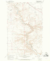
1966 Map of Cut Bank SE
USGS Topo · Published 1969About this map
The Blackfeet Indian Res Bdy bisects the landscape in this mid-1960s study of Glacier County, defining the western edge of the high plains topography. The meandering Cut Bank Creek carves a deep valley through the center of the sheet, providing a sharp contrast to the surrounding plateau. This area is characterized by a mid-century industrial and transport infrastructure, notably the Great Northern railroad line that skirts the northern boundary near the Refinery. Evidence of the region’s economic reliance on resource extraction is visible through numerous Oil Wells and Gravel Pits scattered across the terrain. Leisure and community hubs are represented by the Rodeo Ground and a Drive-in Theater situated on the outskirts of the primary settlement area, while the Cut Bank Airport serves as a vital regional link.
Find a feature on this map
18 named features on this map. Tap any name to fly to it.
Don’t see what you’re looking for? This feature index may not catch every label — zoom into the map to look around manually.
Map Details
Editions of this 1966 Cut Bank SE Map
This is the sole edition of this map. No revisions or reprints were ever made.
Other maps of this area

1907 · Blackfoot Res.
USGS Topo · 1:48,000

1909 · Cut Bank
USGS Topo · 1:125,000

1912 · Cut Bank
USGS Topo · 1:125,000

1920 · Dupuyer
USGS Topo · 1:125,000

1934 · Lake Frances
USGS Topo · 1:48,000

1934 · Valier
USGS Topo · 1:62,500

1937 · Valier
USGS Topo · 1:62,500

1937 · Lake Frances
USGS Topo · 1:62,500

1960 · Cut Bank
USGS Topo · 1:250,000

1963 · Cut Bank
USGS Topo · 1:250,000